
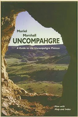
Uncompahgre
Finally back in print is the best historic guide to the fantastic but somewhat camouflaged Uncompahgre Plateau, one of the largest mountains in the American West. With so little written and so little known about such a large part of western Colorado, this reprint is a much requested resource for the foot, auto or armchair traveler. Swift moving, light and casual in style, the book is nevertheless based on careful research. Photography, liberally illustrating the narrative, is also by the author.
- Published
- 1998
- ISBN
- 1-890437-06-9
- Pages
- 220
- Category
- History
- Place
- Colorado
- Publisher
- Western Reflections
- Listed at
- $18.29
Publication details from Open Library. The price shown is the last one on record and is historic, not a current offer.
- Direct from us info@westernreflectionspublishing.com or (336) 565-6915. We pack and post from Lake City.
- Amazon Buy from Amazon.
- Any bookshop Quote ISBN 1-890437-06-9 and your local bookseller can order it.
About this book
Uncompahgre is a guide to the Uncompahgre Plateau, the broad upland in western Colorado that the description calls one of the largest mountains in the American West. It is also, the description admits, somewhat camouflaged. Most people drive past it without knowing how much is up there.
Muriel Marshall wrote it for three kinds of traveler: the person on foot, the person in a car and the person in an armchair. The style is swift moving, light and casual, yet the book rests on careful research. Marshall also took the photographs, and they are used liberally alongside the narrative.
This is a reprint. The description says the book is finally back in print and that it was much requested, because so little has been written about so large a part of western Colorado. A 1999 note in High Country News calls the guide updated and says Marshall first published it about twenty years earlier, which points to the late 1970s. We could not find a firm date for that first printing, so we won't give one. Open Library's subject headings for this edition are automobile travel, guidebooks and history.
What is inside
A plateau seen three ways
The book is pitched at foot, auto and armchair travelers, so it works on the road or at home.
Historic guide
The description calls it the best historic guide to the plateau, with the past of the place woven into the travel.
Marshall's photographs
Photography by the author illustrates the narrative liberally throughout.
Careful research, easy style
The telling is light and casual, but the description stresses that it is based on careful research.
Automobile travel
Automobile travel is one of the subject headings recorded for this edition, so expect routes you can drive.
A large, little known region
It fills a gap, since little has been written about this big part of western Colorado.
Who it is for
Uncompahgre suits visitors planning drives or hikes in western Colorado, residents of Delta, Montrose and the surrounding valleys who want the story of the high ground above them, and readers of regional history who like a guidebook with some narrative in it. It is also a fair pick for libraries and local collections in the region. If you want a field manual with trail ratings, check the description first; this is a historic guide written in a casual voice, meant to be enjoyed as much as used.
About the author
Muriel Marshall wrote this guide and took its photographs. A 1999 High Country News column called her a former newspaper reporter. She also wrote Red Hole in Time, published by Texas A&M University Press in 1988, and the Western Reflections books on the Adobe Badlands and Grand Mesa. We have no fuller verified biography, so we won't invent one. Her author page lists her three books in our library.
The place and the period
The Uncompahgre Plateau is a large uplift in western Colorado and a distinctive part of the Colorado Plateau. Wikipedia puts its size at about 2,290 square miles across five counties: Delta, Mesa, Montrose, Ouray and San Miguel. It runs roughly 90 miles toward the northwest margin of the San Juan Mountains.
The average elevation is about 9,500 feet. The land rises from the Colorado River at 4,600 feet to Horsefly Peak at 10,300 feet. Big Red, Tabeguache, Spring Creek, Roubideau, Escalante, Big Dominguez and Unaweep canyons cut the upland, separated by generally flat mesas.
Land management is split. The Uncompahgre National Forest and the Bureau of Land Management each hold about 37 percent, and private land, mostly in the Uncompahgre Valley, holds about 25 percent. The name comes from a Ute word that Wikipedia says means Dirty Water or Rocks that make Water Red. That mix of canyon, forest and valley is the country this guide sets out to cover.
Source: Wikipedia, Uncompahgre Plateau
Good to know
Is this a new book or a reprint?
Does it have photographs?
Is it nonfiction?
How do I get a copy of the Uncompahgre guide?


Have a book of your own?
This is the kind of book the house publishes: regional history, biography, memoir and the stories that belong to a place. Send us yours and a person will read it.