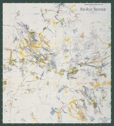
1903 Map of the San Juan Triangle
by Western Reflections Publishing Company
A reproduction of a 1903 map of the San Juan Triangle, the mining country that sits between Silverton, Ouray and Telluride. It records the towns, camps and roads of the district as they stood at the height of the silver and gold years, and it reads well beside the regional histories on this list.
- ISBN
- 978-1-932738-36-0
- Place
- Silverton
- Listed at
- $26.92
The price shown is the last one on record and is historic, not a current offer.
- Direct from us info@westernreflectionspublishing.com or (336) 565-6915. We pack and post from Lake City.
- Amazon Search Amazon for this book. Out of print books usually turn up through marketplace sellers.
- Any bookshop Quote ISBN 978-1-932738-36-0 and your local bookseller can order it.
About this book
1903 Map of the San Juan Triangle is a reproduction of a map made in 1903. It shows the mining country that sits between Silverton, Ouray and Telluride in southwestern Colorado. The catalogue says it records the towns, camps and roads of the district as they stood at the height of the silver and gold years.
It is listed under the publisher's own name, Western Reflections Publishing Company, as the credited author. We have not found who drew the original, so we don't name a mapmaker. The Mining History Association's page on Ouray puts Ouray, Silverton and Telluride in the Silver San Juans mining region, and says those towns arose during the first major mining boom in the 1870s and 1880s.
That page also mentions the Camp Bird gold mine near Ouray, the Old Hundred Mine and the Mayflower Mill at Silverton, and the narrow gauge railroad that runs between Durango and Silverton today. A reader holding the map can look for places like these. We can't say which of them appear on this sheet, because we have not seen its contents and the record does not list them.
Who it is for
This is for anyone who studies or visits the San Juan Mountains and wants a period picture of the district. The description recommends reading it beside the regional histories in the library. Mining history readers, genealogists tracing a family to Silverton, Ouray or Telluride, and hikers curious about old roads are the natural audience. The record does not give the map's size or scale, so check with us before you plan to frame it.
Ways to use this book
Planning a loop through the three towns
Look at the society sites above to see which collections you can visit, and check each one's current season before you set a date. Many small museums keep short schedules.
Tracing a mining camp or a relative
Start with the Silverton newspaper link and the Ouray archive pages. Bring a surname, a mine name or a year, since staff can point you to the right file faster when you ask a specific question.
Reading a map beside the regional histories
Pair this reproduction with other San Juan books on our /library/ pages, and compare place names across them. Names of camps and towns often differ, so keep a short list.
Go deeper
A map of the district between Silverton, Ouray and Telluride is easiest to appreciate beside the places and papers of those three towns. These organizations keep local history for the San Juan mining country.
San Juan County Historical Society
The society behind the Mining Heritage Center in Silverton. Its website lists an archive, a jail and several mining and railroad sites, and links to Silverton newspapers from 1874.
Ouray County Historical Society and Museum
Describes its work as keeping the history of Ouray County and the San Juan Mountains from being lost, with a photograph archive, a paper archive and a library listed on its site.
Durango and Silverton Narrow Gauge Railroad
The railroad's official site, which offers train rides between Durango and Silverton and lists a museum and a behind the scenes tour.
Good to know
What does the map show?
Is it a new map or a reproduction?
Who made the original?
What size is it?
Where can I buy it?


Have a book of your own?
This is the kind of book the house publishes: regional history, biography, memoir and the stories that belong to a place. Send us yours and a person will read it.